
A History of Domewood, Felbridge, Surrey
Felbridge Origins
In pre-historic terms (up to 8300 BC), Felbridge as a place did not exist, but the geology, landscape and conditions of the area could be determined. The area encompassed both the Weald of what we now call Sussex and the Greensand of what we now call Surrey. Historically the area contained very little good agricultural land as the Weald clay was heavy to work, boggy and liable to acquire heavy oak cover, whilst the Greensand, although lighter, was poor in yield. Evidence suggests that in pre-history the area was mostly dense woodland with boggy patches and outcrops of iron-rich sandstone.
Presence of Ironstone
The geological presence of ‘ironstone’ led to future development of the area during the Iron Age and well beyond. Current day clues to the previous development of iron workings include nearby Furnace Wood and Wire Mill.
The first reference made of the area known as Felbridge may well be found in the Doomsday Book of 1089 in the guise of Felmere, meaning “field by a pond”. In the 12th century the name appeared as Feltbruge and then in 1255 Feldbrigge, meaning “bridge by the field or open land”.
Hedgecourt Park
The first document relating to the land holding later named Hedgecourt and centuries before its sub-division, is at the foot of a fine from 2nd May 1290. The fine included “the payment of one red rose at Midsummer to John de Berewyk of the manor of Tylemunderson”. There had been speculation about the existence of Tylemunderson and that it could have been a fictitious place. However, its name became lost as it later became known as Hedgecourt.
Leased for £40
The manor of Hedgecourt was then leased by Sir Edward Gage to John Thorpe, yeoman of Horne, for 21 years at £40. The description of the lands includes the demesne lands (land retained and managed by a lord of the manor under the feudal system for his own use) of the manor of Hedgecourt in Sussex and Surrey, with all barns, stables, stalls and other buildings in the park, mills and mill dams in Godstone, Horne, Tandridge, Grinstead and Worth. The lease specifically excluded the furnace or iron workings, houses and buildings.
John Thorpe lived at Hedgecourt Farm, just north of Hedgecourt Lake on the west side of Stubpond Lane. In 1578 John Thorpe extended his existing lease of Hedgecourt, which ended in 1589, by a further 40 years but it cost him £100 and then a further £42 a year after the death of Elizabeth Gage the widow of Sir Edward Gage.
Stop the Production of Guns
Towards the end of the 15th century, alongside the development of the settlements and agriculture in the Felbridge area, industry was developing. There was a hammer mill at Myllwood, now Furnace Wood, dating from the late 1400’s, and later Hedgecourt Mill and Wood Cock Hammer, now the Wire Mill, both originally dated from the 1570’s.In 1588 the lease on Myllwood furnace expired and the furnace also appeared on a list ordered to stop the production of guns.
In 1594 John Gage sold standing timber to John Thorpe in the park of Hedgecourt adjoining Newe Chappell (now Newchapel) including a parcel of trees in Thorne (Thorney) Park, an enclosure of 125 acres. It is possible that this enclosure was sold with the manor of Tylemondesdon to John de Berewyk back in 1290.
Creation of Hedgecourt Lake
Until the mid-16th century Hedgecourt Park would have been mainly woodland and as Hedgecourt Lake had not been created, two water courses meandered across the valley floor; the main one flowing out of Furnace Wood and a lesser flow through what is now Domewood. These would have come together towards the centre of what became Hedgecourt Lake.
Site of Special Scientific Interest
Most of the area that now makes up Hedgecourt SSSI (Site of Special Scientific Interest) was once within Hedgecourt Park. Hedgecourt Park enclosed a large area including Domewood. It ran from Snower Hill (Snow Hill), along the south side of what is now West Park Road to Newe Chappell, then along the west of the A22 to Whittington College, then to the top of Mill Lane, along the line of Mill Lane down to just before the sluice gate at which point it turned back towards Snower Hill.
Thorney Park
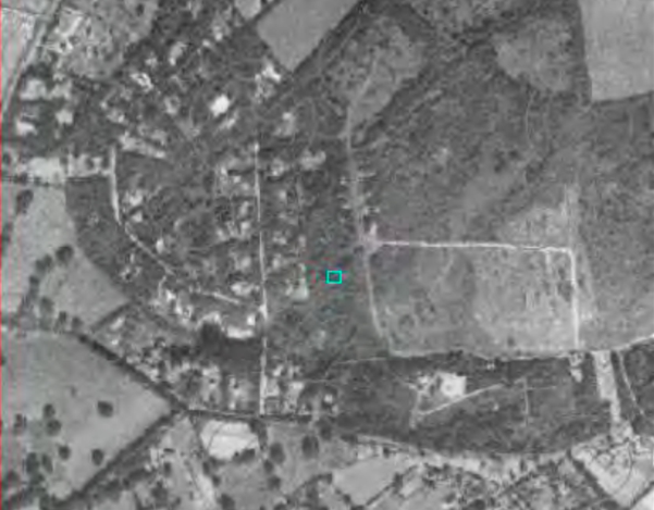
The documents for the last sale made in Thorne Park (later named Thorney Park) have not survived but Thorney Park is marked on the 1748 map of Hedgecourt as a wood where Domewood is today. Thorney Park also included Bakers Wood (500 metres to the east of Domewood along West Park Road), Myllwood (Furnace Wood) and Charts Gill.
There is very little recorded information about our immediate area over the course of the next two centuries, until the sale of a corner of Thorney Park to a Danish businessman in 1933.
Creation of Domewood
On 26th September 1933, HM Land Registry posted in The London Gazette “the freehold of land lying between Crawley Down Middle Road and Bakers Wood and Perry Farm with a frontage to road leading from Crawley Down to Croydon, Horne, Surrey, and Worth, Sussex”, had been acquired by Svend Aage Dohm of 68 Victoria Street, London S.W.I. Ownership was then transferred to his company Domewood Park Estates. Svend Dohm also purchased another parcel of land in Harestone Valley, Caterham, opposite Caterham School, which was developed by Dome Hill Estates.

Domewood Park Estates initially developed the area we know today as “Old Domewood”. In April 1934 it was reported in the Surrey Mirror & County Post that Godstone Rural Council had approved plans for 17 bungalows on the Domewood Lake Estate at Thorney Park.
Tudor Cottage – Bargain at £595
On 31st July 1934 the following advert appeared in The Times. “Amidst beautiful undulating Surrey woodlands, remote from noise of traffic, artistic Tudor Cottage, ideal for retired or active business people, bath, wc, cold & hot water, electric light. Bargain £595. Domewood, Copthorne, Surrey.”
In November that year, the Rural Council then approved plans for a total of 22 houses. Additionally, the East Surrey Water Company were instructed by the Council to “install a fire hydrant on the estate land and to install another hydrant in Copthorne, and to convert the “wash out” in the Western-road. The estimated cost of these hydrants to be £30”.
The First 5 Domewood Properties
The first of the 22 properties were built here in 1934 and the first five properties to be constructed were named Heather Cottage, Lodester, Foxglove Cottage, Little Coppice, The Spinney and Valetta. The houses were two-bedroomed bungalows and locally sourced ‘green’ oak was used to provide their half-timbered ‘Tudor styled’ elevations.

Foxglove Cottage – one of the original five houses
In the Surrey Mirror & County Post dated 28th October 1938 it was reported that “Messers Newell & Burges applied to the Rural Council on Friday for removal of the temporary restrictions against general development of part of Domewood Lake Estate. The Council decided to refuse the application on the grounds that the erection of 21 bungalows would involve excessive expenditure of public money on the provision of sewers or other public services”.
New Roads
Despite a number of legal cases during 1939 against Domewood Lake Estates, in August that year the Surrey Mirror & County Post reported “The Rural Council have approved two new roads on the Domewood Lake Estate, for South County Freeholds Ltd. Plans for three bungalows on the estate have also been approved”.One of these roads was from the junction of ‘the loop’ road and ‘the straight’ road to West Park Road, and the other ran from ‘the straight’ road towards New Domewood.
Friday 1st September 1939’s edition of The Kent & Sussex Courier carried an advert for the sale by auction by Powell & Partner Ltd of “Unique Remaining Woodland Building Sites on the Domewood Lake Estate”. It advertised separate plots with 50ft – 200ft frontages with a combined 2,000ft frontages with an average depth of 200ft, with power, electric light and water laid in the “Excellent Road”.
Spot of Weekend Fun
Local Domewood ‘folklore’ holds true that some of the properties were purchased by London based film studios for their bosses to use with their chosen starlets, as a stopping off point when they could not wait to reach Brighton for a spot of ‘weekend fun’!
Amongst the conditions to which purchasers had to agree were not to keep pigs, nor to burn lime. The latter point is of historical interest because there had been a lime kiln close to Stub Pond Lane.
The vestiges of the original half-timbered buildings are still in evidence throughout Domewood, although most properties built since 1940, when many of the remaining undeveloped plots were sold, have brick external elevations.
New Domewood
The neighbouring land referred to locally as “New Domewood” was the site of a former quarry and was used as a base for Canadian troops in the Second World War. Whilst there the soldiers were billeted in wooden huts and laid hardcore roadways (now Herons Lea and Herons Close).
After the war, and despite local objections, planning permission was granted for residential development in 1954.
A copy of The Times dated 18th July 1958 displayed an advert stating “NEAR EAST GRINSTEAD, DOMEWOOD ESTATE. 38 acres Building Land. Planning permission for 41 units: hardcore Estate Roads, wooded undulating site; services available. FREEHOLD AUCTION 2:30pm Thursday 24th July, the Whitehall Restaurant, East Grinstead. This led to the development of New Domewood.

Enlargement of Original Bungalows
Many properties in Old Domewood were enlarged to become family residences within a tranquil wooded environment. However, the area did not benefit from mains drainage and so wastewater from each property had to be stored in cesspools. This was not ideal in an area with poor surface water drainage and a high-water table, and so restricted future development!
Challenge to obtain Mains Drainage
The lack of mains drainage became a major nuisance, let alone a significant expense, for households for decades. Approximately 30 years ago, three residents investigated the possibility of installing mains drainage which led to proposals being tabled to construct a system at a cost of £7,000 per household, but these proposals were rejected.
During additional research it was discovered that because the stream running through Domewood fed into Hedgecourt Lake, which as stated earlier is an SSSI, under European Union legislation it is necessary for water feeding an SSSI to be clear of any potential threat of pollution. As a result in 1997, Southern Water were legally required to install mains drainage, and residents just had to pay a modest connection charge.
Introduction of Mains Gas
In 1984 the Effingham Park Hotel gained planning permission to build additional bedrooms. As part of this development it was necessary for mains gas to be piped along West Park Road to the hotel. This was a major benefit to Domewood residents because British Gas offered to extend the mains pipework into ‘the wood’, and most residents took advantage of this new mains service, although some did decide to retain oil-fired heating and bottled gas.
Threat of Further Development Thwarted by DPRA Ltd
In January 1990 two residents heard that a non-resident was looking to buy the roads and verges of Old Domewood to gain access to a parcel of land, which he wanted to develop for housing. The Residents Association committee of the day quickly stepped in and thwarted this by purchasing the roads and verges for a token sum, forming DPRA Ltd — a non-trading, corporate body that was set up to hold the assets on behalf of all Domewood residents. Over time, new residents have taken up a shareholding in this company and nowadays every householder is also a shareholder, with the company being entirely owned by the residents it serves.
Between 1990 and 2021, DPRA Ltd held the roads and verges, while a separate resident’s committee organised the day-to-day maintenance of the estate. In 2021, this arrangement was simplified, with the two bodies merging under the DPRA Ltd heading.